The Watershed, at Print Size
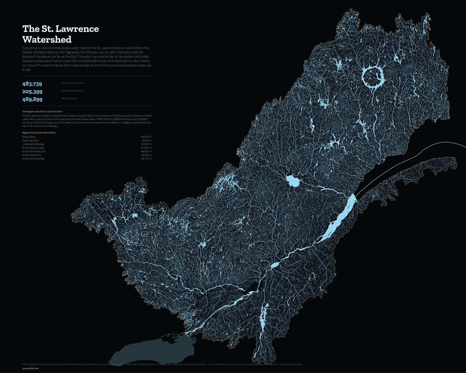

Every river and stream in two countries whose water reaches the St. Lawrence below Lake Ontario, drawn large enough to hang. Free, at full resolution.
9,000 × 7,200 pixels at 300 DPI, which is 30 × 24 inches on paper. Print smaller and it only gets sharper.
| River | Miles of stream above it | Miles under its own name |
|---|---|---|
| Ottawa River | 150,912 | 734 |
| Saguenay River | 97,118 | 51 |
| La Grande Décharge | 87,335 | 30 |
| Rivière Manicouagan | 50,885 | 139 |
| Rivière Saint-Maurice | 49,084 | 194 |
| Rivière Péribonka | 32,188 | 337 |
| Rivière aux Outardes | 25,772 | 307 |
| Rivière Gatineau | 25,183 | 207 |
What it is drawn from
No single agency draws this basin. USGS's Watershed Boundary Dataset has exactly three St. Lawrence subregions and they stop at Quebec City; everything past that, and the whole north shore, and the Ottawa, is in no unit of it at all. Canada files the rest as Water Survey sub-sub-drainage areas, and ninety-two of those make the Canadian side. Unioned, the two come to 531,981 square kilometres in one connected polygon with no holes.
The water is each country's own survey: NHD High Resolution in the United States, the National Hydro Network in Canada, the second restated in the first's vocabulary so that a reach in Quebec and a reach in New York are drawn by the same code. Both surveys will happily draw the other's country, and letting them would put a thousand kilometres of border on the sheet twice in two different hands, so each is cut back to its own side and the seam is the border itself.
Neither survey draws the river. A drainage area bounds the land that drains to a river, so the channel is the line between two of them and falls out of both. The trunk here is OpenStreetMap's, cut back to exactly the reaches the two national surveys leave out.
The biggest river on the sheet is not from the sheet
The St. Lawrence crosses at Cape Vincent already carrying 77,629 miles of stream off 762,914 square kilometres of Great Lakes basin, none of it drawn here. So it is not measured on this sheet, it is flagged, and drawn at the top of the scale where it belongs. Everything the basin below adds is 483,739 miles, of which 457,137 are Canadian. The largest river the basin actually owns is the Ottawa, at 150,912.
Printing it
It is a lot of dark ink. A matte or lustre paper holds the fine streams better than glossy, and any print shop that takes a 300 DPI JPEG can run it at 30 by 24. Smaller is fine too: at 15 by 12 it is 600 DPI and the headwaters are still there.
Free to print and hang, yours or a gift. If you sell it, that is not free. ☕ Coffee if it ends up on your wall.
There is a sheet of the five Great Lakes this river drains, and one of Lake Ontario alone, drawn finer still.